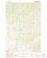
1987 Map of Mc Lain Gulch
USGS Topo · Published 1987About this map
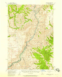
The Wallowa-Whitman National Forest and the Hells Canyon National Recreation Area meet in this 1980s landscape, where a dense network of gulches and creeks drains toward the Snake River corridor. The map highlights the transition between protected forest lands and recreation zones, centered around the rugged drainage of Mc Lain Gulch. Notable for its absence of established towns, the area is instead defined by its natural water features like Hunsaker Creek and North Pine Creek, alongside smaller landmarks such as Gregg Spring and McGee Spring. For those tracing historical land use, the presence of a Gravel Pit and the Roadside Park suggests the modest infrastructure supporting travel through this remote Baker County terrain. The survey captures a moment when the wild character of Grouse Flat and the surrounding canyons remained largely defined by topography and forest boundaries.
Find a feature on this map
27 named features on this map. Tap any name to fly to it.
Don’t see what you’re looking for? This feature index may not catch every label — zoom into the map to look around manually.
Map Details
Editions of this 1987 Mc Lain Gulch Map
This is the sole edition of this map. No revisions or reprints were ever made.
Other maps of this area

1915 · Pine
USGS Topo · 1:125,000
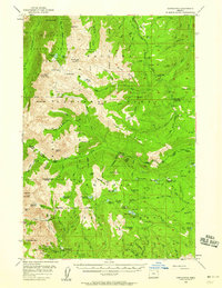
1954 · Cornucopia
USGS Topo · 1:62,500

1955 · Baker
USGS Topo · 1:250,000

1955 · Grangeville
USGS Topo · 1:250,000
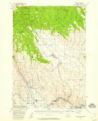
1957 · Halfway
USGS Topo · 1:62,500
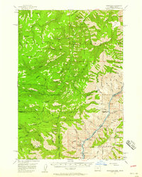
1957 · Homestead
USGS Topo · 1:62,500
1957 · Copperfield
USGS Topo · 1:62,500

1959 · Baker
USGS Topo · 1:250,000

1959 · Grangeville
USGS Topo · 1:250,000

1980 · McCall
USGS Topo · 1:100,000