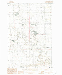
1984 Map of Mc Laren Reservoir
USGS Topo · Published 1984About this map
The agricultural and hydrological landscape of Blaine County is defined by the complex water management systems found on this 1984 provisional survey. At the center of the sheet, Mc Laren Reservoir and Holm Reservoir serve as vital catchment points within a terrain marked by deep coulees and seasonal drainages. The most significant engineering feature is the North Chinook Irrigation Canal, which diverts water across the prairie to support local ranching and farming operations. The map records a sparsely populated region where life follows the natural contours of Lodge Creek and Battle Creek. Researchers of Montana's water history will find interest in the connectivity between North Chinook Reservoir and the network of coulees like Thibadeau Coulee and Hay Coulee that drain the high plains, illustrating the careful orchestration of water rights and land use in this arid environment.
Find a feature on this map
8 named features on this map. Tap any name to fly to it.
Don’t see what you’re looking for? This feature index may not catch every label — zoom into the map to look around manually.
Map Details
Editions of this 1984 Mc Laren Reservoir Map
This is the sole edition of this map. No revisions or reprints were ever made.
Other maps of this area

1904 · Yantic
USGS Topo · 1:62,500

1904 · Havre
USGS Topo · 1:62,500

1912 · Zurich
USGS Topo · 1:125,000

1912 · Thibedeau Lake
USGS Topo · 1:125,000

1953 · Havre
USGS Topo · 1:250,000

1957 · Havre
USGS Topo · 1:250,000

1958 · Havre
USGS Topo · 1:250,000

1964 · Telescope Coulee
USGS Topo · 1:24,000
1964 · Reservoir Coulee
USGS Topo · 1:24,000
1964 · Havre NE
USGS Topo · 1:24,000