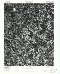
1977 Map of Mc Leansville
USGS Topo · Published 1979About this map
Mc Leansville and the surrounding Guilford County countryside are captured in this 1977 orthophotograph, revealing the transition from rural acreage to late-century suburban development. The aerial imagery provides a clear look at the agricultural patterns and woodlots that defined the area before significant modern expansion. Notable small communities like Sedalia and Greesons Crossroads appear as clusters of activity within the broader landscape of fields and forest. The drainage of South Buffalo Creek and Big Alamance Creek shapes the local topography, with Hackett Lake serving as a distinct water feature. Genealogists and local historians can use this aerial view to identify specific property layouts and road networks as they existed in the late 1970s, including the areas near Mt Zion and Bessemer.
Find a feature on this map
8 named features on this map. Tap any name to fly to it.
Don’t see what you’re looking for? This feature index may not catch every label — zoom into the map to look around manually.
Map Details
Editions of this 1977 Mc Leansville Map
This is the sole edition of this map. No revisions or reprints were ever made.
Other maps of this area

1951 · Lake Brandt
USGS Topo · 1:24,000

1951 · Browns Summit
USGS Topo · 1:24,000

1951 · Greensboro
USGS Topo · 1:24,000

1952 · Mc Leansville
USGS Topo · 1:24,000

1953 · Raleigh
USGS Topo · 1:250,000

1953 · Greensboro
USGS Topo · 1:250,000

1954 · Greensboro
USGS Topo · 1:250,000

1954 · Raleigh
USGS Topo · 1:250,000

1962 · Greensboro
USGS Topo · 1:250,000

1966 · Greensboro
USGS Topo · 1:250,000