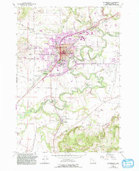
1957 Map of Mc Minnville
USGS Topo · Published 1993About this map
Mcminnville and the winding reaches of the Yamhill River define this mid-century look at Yamhill County. As a hub of agricultural and educational activity, the city is anchored by the campus of Linfield College and a network of community institutions, including the Mcminnville Grange Hall, the County Fairgrounds, and several local schools like W T Newby Sch. The landscape is etched by the Southern Pacific railroad, which historically connected the valley's smaller outposts like Whiteson, St Joseph, and Eola Village. Toward the south, the terrain rises into the Amity Hills and Walnut Hill, where the land transitions from the dense street grids of the city to orchards and farmland. Genealogists will find significant detail in the inclusion of several burial sites, such as the Masonic Cemetery, St James Cemetery, and Taylor Cemetery, providing a clear record of local family history and settlement patterns during this era of growth.
Find a feature on this map
60 named features on this map. Tap any name to fly to it.
Don’t see what you’re looking for? This feature index may not catch every label — zoom into the map to look around manually.
Map Details
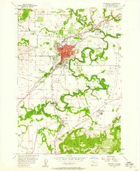
Editions of this 1957 Mc Minnville Map
3 editions found
Other maps of this area

1924 · Mc Minnville
USGS Topo · 1:48,000

1926 · Mc Minnville
USGS Topo · 1:62,500

1940 · McMinnville
USGS Topo · 1:62,500

1941 · Yamhill
USGS Topo · 1:62,500

1942 · Sheridan
USGS Topo · 1:62,500

1942 · Yamhill
USGS Topo · 1:62,500

1942 · Fairdale
USGS Topo · 1:62,500

1948 · Vancouver
USGS Topo · 1:250,000

1950 · Vancouver
USGS Topo · 1:250,000

1950 · Vancouver
USGS Topo · 1:250,000