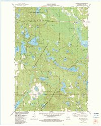
1982 Map of Mc Naughton
USGS Topo · Published 1983About this map
The settlement of McNaughton and the expansive glacial lake system of Oneida County define this early 1980s topographic survey. Large portions of the landscape are dedicated to public land, including the Northern Highland-American Legion State Forest and the Cassian-Woodboro County Recreation Area. This pattern of land use preserves a dense concentration of water bodies such as Mildred Lake, Alva Lake, and Oneida Lake.
Find a feature on this map
75 named features on this map. Tap any name to fly to it.
Don’t see what you’re looking for? This feature index may not catch every label — zoom into the map to look around manually.
Map Details
Editions of this 1982 Mc Naughton Map
This is the sole edition of this map. No revisions or reprints were ever made.
Other maps of this area

1930 · Robbins
USGS Topo · 1:48,000

1938 · Minocqua
USGS Topo · 1:48,000

1938 · Robbins
USGS Topo · 1:48,000

1939 · Cassian
USGS Topo · 1:48,000

1940 · Rhinelander
USGS Topo · 1:48,000

1942 · Cassian
USGS Topo · 1:48,000

1945 · Robbins
USGS Topo · 1:48,000

1946 · Minocqua
USGS Topo · 1:48,000

1949 · Rhinelander
USGS Topo · 1:48,000

1949 · Minocqua
USGS Topo · 1:48,000