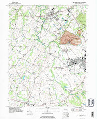
1990 Map of Mc Sherrystown
USGS Topo · Published 1995About this map
The borough of McSherrystown and the village of New Oxford anchor this late-twentieth-century landscape in Adams County, where agricultural heritage meets industrial infrastructure. The terrain is defined by the South Branch Conewago Creek and the notable elevations of Pigeon Hill and Mount Misery. Large-scale extraction is evident at the Quarry near Bittinger, while educational and religious institutions like St Joseph Academy and St Vincents Ch serve the concentrated populations.
Find a feature on this map
81 named features on this map. Tap any name to fly to it.
Don’t see what you’re looking for? This feature index may not catch every label — zoom into the map to look around manually.
Map Details
Editions of this 1990 Mc Sherrystown Map
This is the sole edition of this map. No revisions or reprints were ever made.
Other maps of this area

1905 · Westminster
USGS Topo · 1:62,500

1908 · Gettysburg
USGS Topo · 1:62,500

1911 · Taneytown
USGS Topo · 1:62,500

1920 · Hanover
USGS Topo · 1:62,500

1922 · Hanover
USGS Topo · 1:62,500

1942 · Gettysburg
USGS Topo · 1:125,000

1944 · Manchester
USGS Topo · 1:31,680

1944 · Gettysburg
USGS Topo · 1:31,680

1944 · Mc Sherrystown
USGS Topo · 1:31,680

1944 · Littlestown
USGS Topo · 1:31,680