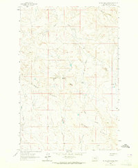
1963 Map of Mc Williams Springs
USGS Topo · Published 1965About this map
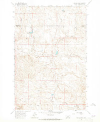
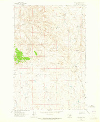
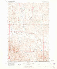
Gumbo Ridge dominates this Garfield County landscape, bisecting the terrain with a distinct topographical divide that separates numerous drainages. These drainage systems, primarily identified as coulees, define the water-scarce environment of central Montana during the early 1960s. Mc Williams Springs and Taylor Spring represent critical water sources in a region characterized by deep cuts like Seider Coulee and Diego Coulee. A notable landmark, Black Butte, rises near the center of the survey area, providing a prominent natural navigational point. The map also records the location of a Drill Hole, signifying early resource exploration or water well development in this portion of the northern plains. The arrangement of Calf Creek and Skeleton Creek in the north further illustrates the intricate network of seasonal waterways that shaped local land use and ranching boundaries.
Find a feature on this map
14 named features on this map. Tap any name to fly to it.
Don’t see what you’re looking for? This feature index may not catch every label — zoom into the map to look around manually.
Map Details
Editions of this 1963 Mc Williams Springs Map
This is the sole edition of this map. No revisions or reprints were ever made.
Other maps of this area

1954 · Jordan
USGS Topo · 1:250,000

1954 · Forsyth
USGS Topo · 1:250,000

1956 · Jordan
USGS Topo · 1:250,000

1957 · Forsyth
USGS Topo · 1:250,000

1958 · Jordan
USGS Topo · 1:250,000

1958 · Forsyth
USGS Topo · 1:250,000
1962 · Kincheloe Ranch
USGS Topo · 1:24,000
1963 · Dutton Ranch
USGS Topo · 1:24,000
1963 · Regnal Coulee
USGS Topo · 1:24,000

1964 · Jordan
USGS Topo · 1:250,000