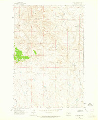
1963 Map of Dutton Ranch
USGS Topo · Published 1965About this map
Dutton Ranch serves as the namesake hub of this Garfield County landscape, surveyed in the early 1960s. The terrain is defined by a dense network of coulees and spring-fed drainages, reflecting the complex erosion patterns of the Gumbo Ridge area. Water sources like Mud Springs, Chalk Springs, and Breed Springs appear as critical landmarks in an otherwise arid environment, essential for the livestock operations that dominate this portion of eastern Montana.
Find a feature on this map
16 named features on this map. Tap any name to fly to it.
Don’t see what you’re looking for? This feature index may not catch every label — zoom into the map to look around manually.
Map Details
Editions of this 1963 Dutton Ranch Map
2 editions found
Other maps of this area

1954 · Jordan
USGS Topo · 1:250,000

1954 · Forsyth
USGS Topo · 1:250,000

1956 · Jordan
USGS Topo · 1:250,000

1957 · Forsyth
USGS Topo · 1:250,000

1958 · Jordan
USGS Topo · 1:250,000

1958 · Forsyth
USGS Topo · 1:250,000

1962 · Kincheloe Ranch
USGS Topo · 1:24,000

1962 · Mosby SE
USGS Topo · 1:24,000
1963 · Hill Ranch
USGS Topo · 1:24,000

1963 · Mc Williams Springs
USGS Topo · 1:24,000