
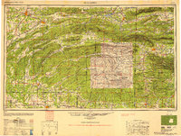
1950 Map of Mcalester
USGS Topo · Published 1950About this map
McAlester and the surrounding coal-rich Choctaw Nation country define the northwestern corner of this mid-century survey. The landscape is dominated by the complex ridgelines of the Ouachita Mountains, including the prominent Kiamichi Mountain and the distinctive Potato Hills. This era shows a robust rail-and-road network essential to the region's resource extraction and timber industries, with the Chicago Rock Island and Pacific RR and the Kansas City Southern Ry providing vital transport links through towns like Hartshorne and Wilburton.
Find a feature on this map
131 named features on this map. Tap any name to fly to it.
Don’t see what you’re looking for? This feature index may not catch every label — zoom into the map to look around manually.
Map Details
Editions of this 1950 Mcalester Map
2 editions found
Other maps of this area

1879 · Poteau Mountain
USGS Topo · 1:62,500

1887 · Poteau Mountain #1
USGS Topo · 1:62,500

1887 · Mount Ida #2
USGS Topo · 1:62,500

1887 · Magazine Mountain #3
USGS Topo · 1:62,500

1887 · Magazine Mountain
USGS Topo · 1:62,500

1887 · Poteau Mountain #2
USGS Topo · 1:62,500

1887 · Greenwood
USGS Topo · 1:62,500

1890 · Magazine Mountain
USGS Topo · 1:125,000

1890 · Mount Ida
USGS Topo · 1:125,000

1890 · Fort Smith
USGS Topo · 1:125,000