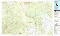
1984 Map of McArthur
USGS Topo · Published 1984About this map
McArthur and the surrounding agricultural valleys are the focal point of this 1980s landscape, where the Fall River and Pit River converge. The terrain is a complex of volcanic features and water-rich lowlands, including the vast Big Swamp and Big Lake near Glenburn. To the west, the McCloud River cuts through the Shasta National Forest, while the eastern portion is dominated by the Modoc National Forest and the heights of the Whitehorse Mountains.
Find a feature on this map
42 named features on this map. Tap any name to fly to it.
Don’t see what you’re looking for? This feature index may not catch every label — zoom into the map to look around manually.
Map Details
Editions of this 1984 McArthur Map
This is the sole edition of this map. No revisions or reprints were ever made.
Other maps of this area

1886 · Alturas
USGS Topo · 1:250,000

1886 · Honey Lake
USGS Topo · 1:250,000

1886 · Lassen Peak
USGS Topo · 1:250,000

1886 · Modoc Lava Bed
USGS Topo · 1:250,000

1886 · Shasta
USGS Topo · 1:250,000

1890 · Red Bluff
USGS Topo · 1:250,000

1891 · Honey Lake
USGS Topo · 1:250,000

1892 · Modoc Lava-Bed
USGS Topo · 1:250,000

1892 · Lassen Peak
USGS Topo · 1:250,000

1892 · Alturas
USGS Topo · 1:250,000