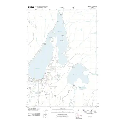
2011 Map of McCall
USGS Topo · Published 2011About this map
Payette Lake and Little Payette Lake anchor this recreational and wildland management hub in the Central Idaho mountains. The town of McCall serves as the primary gateway, hosting critical infrastructure for regional aviation and forest protection at the McCall Airport and the Smoke Jumper Loft. Along the eastern shore of the larger lake, social and youth history is reflected at the Alice Pittinger Girl Scout Camp and the Victory Cove Church Camp, while the McCall Fish Hatchery indicates the long-standing importance of local aquatic management near the North Fork Payette River.
Find a feature on this map
54 named features on this map. Tap any name to fly to it.
Don’t see what you’re looking for? This feature index may not catch every label — zoom into the map to look around manually.
Map Details
Editions of this 2011 McCall Map
This is the sole edition of this map. No revisions or reprints were ever made.
Other maps of this area

1911 · Meadows
USGS Topo · 1:125,000

1938 · Riggins
USGS Topo · 1:96,000

1945 · Riggins
USGS Topo · 1:125,000

1955 · Baker
USGS Topo · 1:250,000

1955 · Grangeville
USGS Topo · 1:250,000

1956 · Elk City
USGS Topo · 1:250,000

1957 · Challis
USGS Topo · 1:250,000

1959 · Baker
USGS Topo · 1:250,000

1959 · Grangeville
USGS Topo · 1:250,000

1960 · Elk City
USGS Topo · 1:250,000