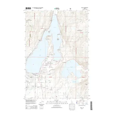
2013 Map of McCall
USGS Topo · Published 2013About this map
Payette Lake serves as the focal point of this recreational and administrative landscape, where the town of McCall transitions from a lakeside community into the expansive Payette National Forest. The map documents the intricate mix of public service and private leisure, featuring the McCall Forest Supervisor Office and the specialized Smoke Jumper Loft near the Mc Call Municipal Airport. Along the shoreline and wooded slopes, specific enclaves such as Sylvan Beach, Timber Ridge, and the Alice Pittenger Girl Scout Camp reflect the area's development as a destination for seasonal residence and youth organizations.
Find a feature on this map
88 named features on this map. Tap any name to fly to it.
Don’t see what you’re looking for? This feature index may not catch every label — zoom into the map to look around manually.
Map Details
Editions of this 2013 McCall Map
This is the sole edition of this map. No revisions or reprints were ever made.
Other maps of this area

1911 · Meadows
USGS Topo · 1:125,000

1938 · Riggins
USGS Topo · 1:96,000

1945 · Riggins
USGS Topo · 1:125,000

1955 · Baker
USGS Topo · 1:250,000

1955 · Grangeville
USGS Topo · 1:250,000

1956 · Elk City
USGS Topo · 1:250,000

1957 · Challis
USGS Topo · 1:250,000

1959 · Baker
USGS Topo · 1:250,000

1959 · Grangeville
USGS Topo · 1:250,000

1960 · Elk City
USGS Topo · 1:250,000