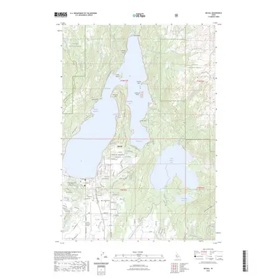
2023 Map of McCall
USGS Topo · Published 2023About this map
Payette Lake dominates this 2023 survey of central Idaho, its deep waters framed by the Payette National Forest and the rising slopes of Timber Ridge. The resort community of McCall anchors the southern shore, showing a developed grid of residential streets like Flynn Ln and Aspen Loop alongside critical local infrastructure. The local economy and environment are represented by the McCall Fish Hatchery and the McCall Municipal Airport, which serve the upper Long Valley region.
Find a feature on this map
117 named features on this map. Tap any name to fly to it.
Don’t see what you’re looking for? This feature index may not catch every label — zoom into the map to look around manually.
Map Details
Editions of this 2023 McCall Map
This is the sole edition of this map. No revisions or reprints were ever made.
Other maps of this area

1911 · Meadows
USGS Topo · 1:125,000

1938 · Riggins
USGS Topo · 1:96,000

1945 · Riggins
USGS Topo · 1:125,000

1955 · Baker
USGS Topo · 1:250,000

1955 · Grangeville
USGS Topo · 1:250,000

1956 · Elk City
USGS Topo · 1:250,000

1957 · Challis
USGS Topo · 1:250,000

1959 · Baker
USGS Topo · 1:250,000

1959 · Grangeville
USGS Topo · 1:250,000

1960 · Elk City
USGS Topo · 1:250,000