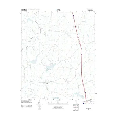
2012 Map of McCarley
USGS Topo · Published 2012About this map
McCarley sits at the heart of this rural landscape, which is defined by an intricate network of waterways draining toward the Big Sand Creek basin. The area is notable for its high concentration of family and community burial grounds, including Prospect Cem, Primitive Cem, and Pink Flower Cem, offering significant value for genealogical research in Montgomery County. These sites are scattered across a terrain shaped by winding creeks like Magic Creek and Sykes Creek.
Find a feature on this map
53 named features on this map. Tap any name to fly to it.
Don’t see what you’re looking for? This feature index may not catch every label — zoom into the map to look around manually.
Map Details
Editions of this 2012 McCarley Map
This is the sole edition of this map. No revisions or reprints were ever made.
Other maps of this area

1953 · West Point
USGS Topo · 1:250,000

1954 · Duck Hill
USGS Topo · 1:62,500

1954 · McCarley
USGS Topo · 1:62,500

1958 · West Point
USGS Topo · 1:250,000

1963 · West Point
USGS Topo · 1:250,000

1966 · Winona
USGS Topo · 1:24,000

1968 · Winona
USGS Topo · 1:62,500
1975 · Bailey Lake
USGS Topo · 1:24,000
1975 · Coila
USGS Topo · 1:24,000
1978 · Coila
USGS Topo · 1:62,500