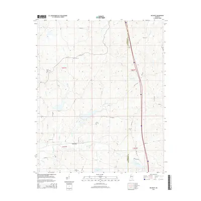
2015 Map of McCarley
USGS Topo · Published 2015About this map
McCarley serves as the primary settlement hub for this rural stretch of Mississippi, where the border of Carroll Co and Montgomery Co divides the landscape. This map documents a high density of burial sites and small churches, which often serve as the only remaining physical markers of nineteenth-century family landholdings and early communities. Genealogists will find a wealth of specific locations including Prospect Cem, Primitive Cem, and Hickory Grove Cem, among several others.
Find a feature on this map
57 named features on this map. Tap any name to fly to it.
Don’t see what you’re looking for? This feature index may not catch every label — zoom into the map to look around manually.
Map Details
Editions of this 2015 McCarley Map
This is the sole edition of this map. No revisions or reprints were ever made.
Other maps of this area

1953 · West Point
USGS Topo · 1:250,000

1954 · Duck Hill
USGS Topo · 1:62,500

1954 · McCarley
USGS Topo · 1:62,500

1958 · West Point
USGS Topo · 1:250,000

1963 · West Point
USGS Topo · 1:250,000

1966 · Winona
USGS Topo · 1:24,000

1968 · Winona
USGS Topo · 1:62,500
1975 · Bailey Lake
USGS Topo · 1:24,000
1975 · Coila
USGS Topo · 1:24,000
1978 · Coila
USGS Topo · 1:62,500