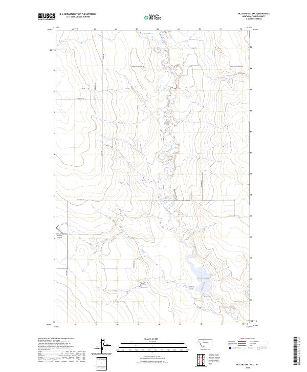
2024 Map of McCarters Lake
USGS Topo · Published 2024About this map
Willow Creek meanders southward through this Toole County landscape, feeding into the neighboring bodies of Mc Carters Lake and McCarter Lake. The map reveals a rural infrastructure defined by long-established family-named thoroughfares such as Hellinger Rd, Albright Ln, and Darwin Snuffer Rd. The agricultural character of the region is punctuated by water management features like Shay Reservoir and the drainage of Trail Creek in the north. Aviation history is noted at the Hellinger Airport located along the western boundary. Local transit history is preserved in the naming of Green Hill School Rd, suggesting the historical locations of community centers in this high plains environment. The terrain is marked by distinct geographical features including Cameron Coulee, which provides a window into the natural drainage patterns of this northern Montana region.
Find a feature on this map
20 named features on this map. Tap any name to fly to it.
Don’t see what you’re looking for? This feature index may not catch every label — zoom into the map to look around manually.
Map Details
Editions of this 2024 McCarters Lake Map
This is the sole edition of this map. No revisions or reprints were ever made.
Other maps of this area

1920 · Conrad
USGS Topo · 1:125,000

1943 · Antelope Coulee
USGS Topo · 1:62,500

1954 · Shelby
USGS Topo · 1:250,000

1958 · Shelby
USGS Topo · 1:250,000

1962 · Hawthorne School
USGS Topo · 1:24,000

1962 · Berkholder Reservoir
USGS Topo · 1:24,000

1962 · Mc Carters Lake
USGS Topo · 1:24,000

1962 · Mc Carters Lake SE
USGS Topo · 1:24,000

1967 · South Devon School
USGS Topo · 1:24,000

1970 · Devon
USGS Topo · 1:24,000