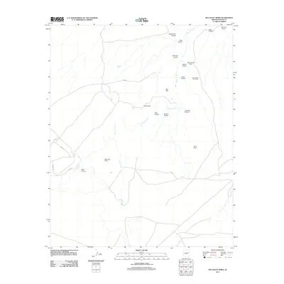
2011 Map of McCauley Sinks
USGS Topo · Published 2011About this map
Chevelon Creek and its complex network of drainage canyons define this high-desert landscape in northern Arizona. The topography is marked by significant geological depressions known as the McCauley Sinks, located near the intersection of several local ranching and access roads including Pinto Rd, Colt Rd, and Lasso Rd. In the northeast, the McCamant Hills rise above the drainage of Willy Canyon and Babbitt Tank Canyon, reflecting the area's history of cattle ranching and water management, evidenced by features like Babbitt Tank. The map also identifies the Second Mesa Campground and distinctive terrain features such as Gods Pocket and the Red Hills, which highlight the intricate erosional patterns of the Colorado Plateau in this part of Navajo and Coconino counties.
Find a feature on this map
24 named features on this map. Tap any name to fly to it.
Don’t see what you’re looking for? This feature index may not catch every label — zoom into the map to look around manually.
Map Details
Editions of this 2011 McCauley Sinks Map
This is the sole edition of this map. No revisions or reprints were ever made.
Other maps of this area

1886 · Holbrook
USGS Topo · 1:250,000

1893 · Holbrook
USGS Topo · 1:250,000

1954 · Holbrook
USGS Topo · 1:250,000
1955 · St. Joseph 2 NW
USGS Topo · 1:24,000

1955 · Joseph City
USGS Topo · 1:62,500

1957 · Holbrook
USGS Topo · 1:250,000

1958 · Holbrook
USGS Topo · 1:250,000

1960 · Holbrook
USGS Topo · 1:250,000
1970 · Hibbard
USGS Topo · 1:24,000
1970 · Relic Point
USGS Topo · 1:24,000