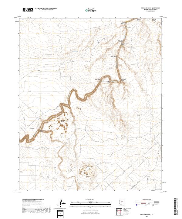
2021 Map of McCauley Sinks
USGS Topo · Published 2021About this map
McCauley Sinks and the winding course of Chevelon Cr define this high-desert landscape in Navajo County. The terrain is deeply incised by a network of drainage systems, including Chevelon Canyon, Black Canyon, and the curiously named Gods Pocket. These canyons create a complex topography that has historically shaped movement and land use in this part of Arizona.
Find a feature on this map
31 named features on this map. Tap any name to fly to it.
Don’t see what you’re looking for? This feature index may not catch every label — zoom into the map to look around manually.
Map Details
Editions of this 2021 McCauley Sinks Map
This is the sole edition of this map. No revisions or reprints were ever made.
Other maps of this area

1886 · Holbrook
USGS Topo · 1:250,000

1893 · Holbrook
USGS Topo · 1:250,000

1954 · Holbrook
USGS Topo · 1:250,000
1955 · St. Joseph 2 NW
USGS Topo · 1:24,000

1955 · Joseph City
USGS Topo · 1:62,500

1957 · Holbrook
USGS Topo · 1:250,000

1958 · Holbrook
USGS Topo · 1:250,000

1960 · Holbrook
USGS Topo · 1:250,000
1970 · Hibbard
USGS Topo · 1:24,000
1970 · Relic Point
USGS Topo · 1:24,000