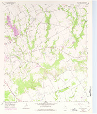
1957 Map of McClanahan
USGS Topo · Published 1978About this map
The small community of Mc Clanahan sits at a nexus of local transport and water systems in Falls County, where drainage is defined by a dense network of creeks including Sandy Creek, Little Sandy Creek, and Keechi Creek. The landscape in the mid-20th century was a working rural environment, characterized by significant water management infrastructure like the Levee and Spillway systems serving Marlin City Lake and New City Lake. For those tracing local heritage, the map identifies several rural houses of worship and burial grounds, such as Marvin Allen Ch, Springhill Ch, and Taylor Chapel Cem. The presence of a Railroad Grade and two distinct landing strips, Marlin Airfield and Stephens Airfield, illustrates the transition between older rail-dependent economies and the burgeoning aviation and pipeline infrastructure of the era, while Bald Hill provides a prominent natural landmark overlooking Elm Creek.
Find a feature on this map
31 named features on this map. Tap any name to fly to it.
Don’t see what you’re looking for? This feature index may not catch every label — zoom into the map to look around manually.
Map Details
Editions of this 1957 McClanahan Map
2 editions found
Other maps of this area

1954 · Waco
USGS Topo · 1:250,000

1955 · Waco
USGS Topo · 1:250,000

1957 · Otto
USGS Topo · 1:24,000

1957 · McClanahan
USGS Topo · 1:24,000

1957 · Riesel
USGS Topo · 1:24,000

1957 · Marlin
USGS Topo · 1:24,000

1962 · Reagan
USGS Topo · 1:24,000

1962 · Cedar Springs
USGS Topo · 1:24,000

1962 · Bremond
USGS Topo · 1:24,000

1965 · Kosse West
USGS Topo · 1:24,000