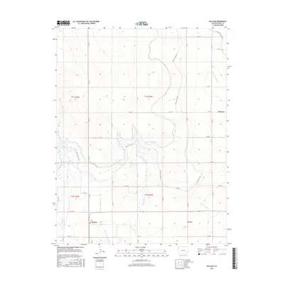
2016 Map of McClave
USGS Topo · Published 2016About this map
McClave and the surrounding plains of Bent County define this landscape, where a sophisticated network of early 21st-century irrigation infrastructure supports High Plains agriculture. The terrain is marked by the presence of the Kicking Bird Canal and the Fort Lyon Canal, which work alongside numerous drainage systems like the McClave Drainage Ditch and Wiley Drainage Ditch to manage water across the township sections. These man-made waterways often follow the natural contours of the land, occasionally intersecting with seasonal features such as Graveyard Creek. To the east, the small settlement of Keesee sits near the Riverview Ditch, while Big Bend occupies the northeast. The layout of the road system, primarily composed of labeled county routes like Co RD NN and Co RD LL, reflects a strictly organized grid typical of rural Colorado, connecting isolated farmsteads and agricultural hubs.
Find a feature on this map
26 named features on this map. Tap any name to fly to it.
Don’t see what you’re looking for? This feature index may not catch every label — zoom into the map to look around manually.
Map Details
Editions of this 2016 McClave Map
This is the sole edition of this map. No revisions or reprints were ever made.
Other maps of this area

1892 · Lamar
USGS Topo · 1:125,000

1952 · Lamar West
USGS Topo · 1:24,000

1953 · Hasty
USGS Topo · 1:24,000

1953 · Prowers
USGS Topo · 1:24,000

1954 · Lamar
USGS Topo · 1:250,000

1955 · McClave
USGS Topo · 1:24,000

1955 · Lubers
USGS Topo · 1:24,000

1955 · Wiley
USGS Topo · 1:24,000

1958 · Lamar
USGS Topo · 1:250,000

1967 · Neenoshe Reservoir
USGS Topo · 1:24,000