
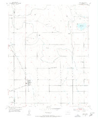
1955 Map of Wiley
USGS Topo · Published 1956About this map
Wiley stands at the center of this 1950s agrarian landscape, where the High Plains were meticulously transformed by a complex network of irrigation infrastructure. The map reveals how the arid terrain of Prowers Co and Bent Co was reclaimed through an intricate system of waterways including the Santanta Canal, the Fort Lyon Canal, and the Clover Meadow Ditch, which fed into the Thurston Reservoir. This hydraulic engineering supported a spread of rural schoolhouses and small settlements linked by the Atchison Topeka and Santa Fe railroad line. Significant local landmarks such as the Wiley Cem and the Radio Beam Sta CAA 3943 appear alongside indicators of the era's educational landscape, including the Clover Meadow Sch and the Cactus View Sch (Aban'd), showing a community in transition between early settlement and modern agricultural development.
Find a feature on this map
24 named features on this map. Tap any name to fly to it.
Don’t see what you’re looking for? This feature index may not catch every label — zoom into the map to look around manually.
Map Details
Editions of this 1955 Wiley Map
2 editions found
Other maps of this area

1892 · Lamar
USGS Topo · 1:125,000

1952 · Lamar West
USGS Topo · 1:24,000

1953 · Lamar East
USGS Topo · 1:24,000

1953 · Prowers
USGS Topo · 1:24,000

1954 · Lamar
USGS Topo · 1:250,000

1955 · McClave
USGS Topo · 1:24,000

1955 · May Valley
USGS Topo · 1:24,000

1958 · Lamar
USGS Topo · 1:250,000

1967 · Neenoshe Reservoir
USGS Topo · 1:24,000
1968 · Chivington SE
USGS Topo · 1:24,000