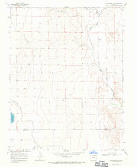
1968 Map of Chivington SE
USGS Topo · Published 1971About this map
Neeskah Reservoir anchors the southwestern portion of this landscape, marking a significant water management site at the Kiowa Co Prowers Co boundary in the late 1960s. The terrain is defined by the winding course of Big Sandy Creek and the drainage of Rush Creek, which flow through a region shaped by agricultural irrigation infrastructure. The map details the technical layout of the Comanche Canal and Pawnee Canal, illustrating how water was diverted across these high plains. Industrial activity is visible in scattered Gravel Pits and isolated drill holes, reflecting the local extraction and resource exploration common to this part of eastern Colorado. This survey provides a clear look at the intersection of natural watercourses and the man-made canal systems that sustained the rural economy between the Kiowa and Prowers county lines.
Find a feature on this map
11 named features on this map. Tap any name to fly to it.
Don’t see what you’re looking for? This feature index may not catch every label — zoom into the map to look around manually.
Map Details
Editions of this 1968 Chivington SE Map
This is the sole edition of this map. No revisions or reprints were ever made.
Other maps of this area

1890 · Granada
USGS Topo · 1:125,000

1892 · Lamar
USGS Topo · 1:125,000

1892 · Granada
USGS Topo · 1:125,000

1894 · Granada
USGS Topo · 1:125,000

1954 · Lamar
USGS Topo · 1:250,000

1955 · Granada NW
USGS Topo · 1:24,000

1955 · May Valley
USGS Topo · 1:24,000

1955 · Wiley
USGS Topo · 1:24,000

1958 · Lamar
USGS Topo · 1:250,000

1967 · Neenoshe Reservoir
USGS Topo · 1:24,000