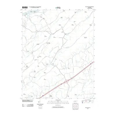
2010 Map of McCloud
USGS Topo · Published 2010About this map
McKinneys Shoals and McKinneys Islands interrupt the Holston River as it flows along the northwestern edge of this landscape, marking a transition from riverine topography to a complex series of ridges and hollows. The area is defined by its deep ancestral roots, evidenced by numerous family burial grounds such as Reynolds Cemetery, Strahl Cemetery, and Patterson Cemetery. Small settlements like Kite and Mount Carmel are connected by a network of rural roads, including Old State Hwy 70 and Butcher Valley Rd. The terrain is significantly articulated by features like Louderback Mountain, Big Mountain, and Brushy Mountain, which channel local drainages such as Dodson Creek and Gap Creek. To the south, Malone Lake Dam and the Rolling G Dam indicate local water management in the valleys near Carter Valley.
Find a feature on this map
106 named features on this map. Tap any name to fly to it.
Don’t see what you’re looking for? This feature index may not catch every label — zoom into the map to look around manually.
Map Details
Editions of this 2010 McCloud Map
This is the sole edition of this map. No revisions or reprints were ever made.
Other maps of this area

1883 · Morristown
USGS Topo · 1:125,000

1892 · Greeneville
USGS Topo · 1:125,000

1893 · Morristown
USGS Topo · 1:125,000

1895 · Morristown
USGS Topo · 1:125,000

1896 · Greeneville
USGS Topo · 1:125,000

1904 · Greeneville
USGS Topo · 1:125,000

1935 · Surgoinsville
USGS Topo · 1:48,000

1935 · Baileyton
USGS Topo · 1:24,000

1935 · Rogersville
USGS Topo · 1:48,000

1935 · McCloud
USGS Topo · 1:24,000