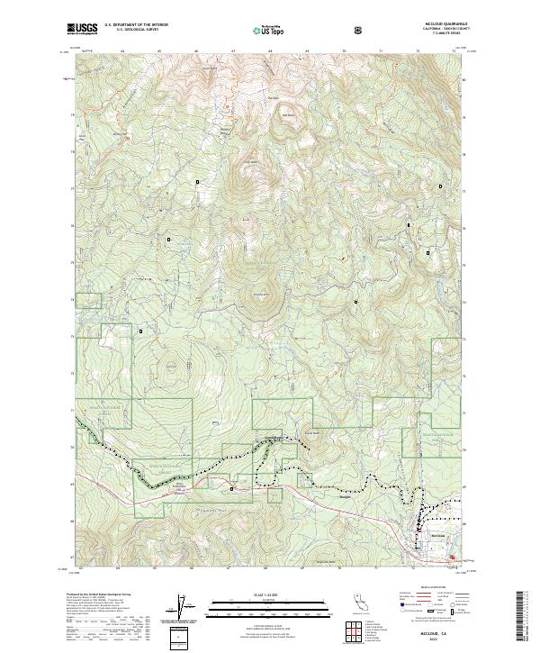
2023 Map of McCloud
USGS Topo · Published 2023About this map
McCloud and the nearby settlement of Hooper anchor the southeastern corner of this map, serving as entry points to the expansive southern slopes of the Cascades. The terrain is defined by a dramatic elevation gain toward the north, where the Mount Shasta Wilderness encompasses prominent landmarks such as The Gate, Sargents Ridge, and Red Butte. The landscape is a complex network of volcanic ridges and deep glaciated valleys like Avalanche Gulch and Cascade Gulch.
Find a feature on this map
59 named features on this map. Tap any name to fly to it.
Don’t see what you’re looking for? This feature index may not catch every label — zoom into the map to look around manually.
Map Details
Editions of this 2023 McCloud Map
This is the sole edition of this map. No revisions or reprints were ever made.
Other maps of this area

1886 · Shasta
USGS Topo · 1:250,000

1894 · Shasta
USGS Topo · 1:250,000

1935 · Dunsmuir
USGS Topo · 1:125,000

1948 · Weed
USGS Topo · 1:250,000

1950 · Weed
USGS Topo · 1:250,000

1954 · Shoeinhorse Mountain
USGS Topo · 1:62,500

1954 · Shasta
USGS Topo · 1:62,500

1954 · Weed
USGS Topo · 1:62,500

1954 · Dunsmuir
USGS Topo · 1:62,500

1958 · Weed
USGS Topo · 1:250,000