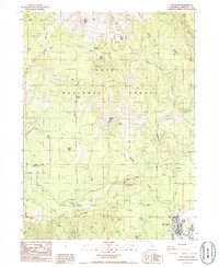
1986 Map of McCloud
USGS Topo · Published 1986About this map
The town of Mc Cloud sits at the foot of massive geological formations within the Shasta National Forest in this mid-1980s topographic survey. The landscape is defined by its dramatic elevation changes, moving from the developed street grid of the settlement up toward the high-altitude landmarks of Green Butte and Red Butte Ridge. This edition preserves the location of specific historical campsites and waypoints like Horse Camp, Bunny Flat, and Wagon Camp, reflecting the area's long-standing use for recreation and transit.
Find a feature on this map
45 named features on this map. Tap any name to fly to it.
Don’t see what you’re looking for? This feature index may not catch every label — zoom into the map to look around manually.
Map Details
Editions of this 1986 McCloud Map
This is the sole edition of this map. No revisions or reprints were ever made.
Other maps of this area

1886 · Shasta
USGS Topo · 1:250,000

1894 · Shasta
USGS Topo · 1:250,000

1935 · Dunsmuir
USGS Topo · 1:125,000

1948 · Weed
USGS Topo · 1:250,000

1950 · Weed
USGS Topo · 1:250,000

1954 · Shoeinhorse Mountain
USGS Topo · 1:62,500

1954 · Shasta
USGS Topo · 1:62,500

1954 · Weed
USGS Topo · 1:62,500

1954 · Dunsmuir
USGS Topo · 1:62,500

1958 · Weed
USGS Topo · 1:250,000