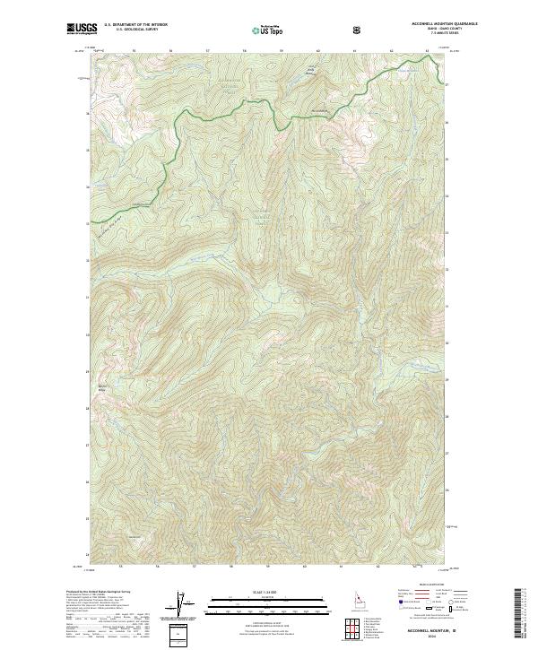
2024 Map of McConnell Mountain
USGS Topo · Published 2024About this map
McConnell Mtn serves as a central landmark within this expansive reach of the Selway-Bitterroot Wilderness, where the high country of the Bitterroot Range defines the drainage patterns of the Clearwater and Nez Perce National Forests. The landscape is characterized by high-elevation meadows and ridges, including the appropriately named Lost Knife Meadows and Chain Meadows near the northern boundary. Water sources like California Lake and the North Fork Moose Creek are primary features of this backcountry terrain. The presence of Wounded Doe Ridge and Barren Ridge suggests a complex topography of high divides that separate the many tributaries flowing into the larger Moose Creek system. This 2024 survey captures the area's contemporary management boundaries as a protected wilderness, reflecting its status as one of the most remote interior regions of the Pacific Northwest.
Find a feature on this map
26 named features on this map. Tap any name to fly to it.
Don’t see what you’re looking for? This feature index may not catch every label — zoom into the map to look around manually.
Map Details
Editions of this 2024 McConnell Mountain Map
This is the sole edition of this map. No revisions or reprints were ever made.
Other maps of this area

1911 · Lolo
USGS Topo · 1:250,000

1913 · Lolo
USGS Topo · 1:250,000

1956 · Hamilton
USGS Topo · 1:250,000

1959 · Hamilton
USGS Topo · 1:250,000

1960 · Hamilton
USGS Topo · 1:250,000

1964 · Hamilton
USGS Topo · 1:250,000

1966 · Mc Connell Mtn
USGS Topo · 1:24,000
1966 · Big Rock Mtn
USGS Topo · 1:24,000
1966 · Freeman Peak
USGS Topo · 1:24,000
1966 · Shissler Peak
USGS Topo · 1:24,000