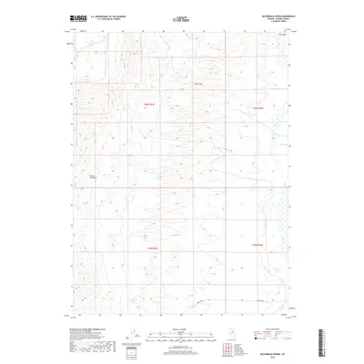
2018 Map of McCormack Spring
USGS Topo · Published 2018About this map
McCormack Spring and Cherry Springs serve as critical water points in this high-elevation corner of Eureka County. The landscape is dominated by the Cortez Mountains, which rise sharply above the drainages of Pine Cr and Trout Cr. This 2018 survey captures the region's ranching and mining infrastructure, centered on the rugged passage of Devils Gate. The presence of Iron Mine Rd in the southern portion of the map suggests the area's continued connection to the mineral-rich history of northern Nevada. This map provides a clear record of the modern township and range grid across these remote basins, illustrating how early surveying lines continue to organize the contemporary high-desert landscape.
Find a feature on this map
11 named features on this map. Tap any name to fly to it.
Don’t see what you’re looking for? This feature index may not catch every label — zoom into the map to look around manually.
Map Details
Editions of this 2018 McCormack Spring Map
This is the sole edition of this map. No revisions or reprints were ever made.
Other maps of this area

1952 · Pine Valley
USGS Topo · 1:62,500

1952 · Carlin
USGS Topo · 1:62,500

1955 · Winnemucca
USGS Topo · 1:250,000

1957 · Frenchie Creek
USGS Topo · 1:62,500

1957 · Beowawe
USGS Topo · 1:62,500

1958 · Winnemucca
USGS Topo · 1:250,000

1962 · Winnemucca
USGS Topo · 1:250,000
1985 · Thatcher Spring
USGS Topo · 1:24,000

1985 · Scotts Gulch
USGS Topo · 1:24,000
1985 · Coffin Mtn
USGS Topo · 1:24,000