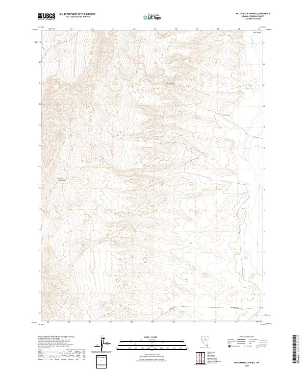
2021 Map of McCormack Spring
USGS Topo · Published 2021About this map
Pine Valley serves as the central geographic feature of this high-desert Nevada landscape, flanked to the west by the steep elevations of the Cortez Mountains. The map documents a sparsely populated but vital hydrological network, including the eponymous McCormack Spring and Cherry Springs, which provide critical water sources in an otherwise arid environment. Evidence of local industry and infrastructure is visible along Iron Mine Rd, which traverses the southern portion of the quadrangle. The topography is further defined by the narrowing of Devils Gate and the drainage systems of Pine Cr and Trout Cr. This survey illustrates the classic Basin and Range structure of Eureka County, where isolated springs and specific access roads like the iron mine route dictate the utility and navigation of the terrain.
Find a feature on this map
12 named features on this map. Tap any name to fly to it.
Don’t see what you’re looking for? This feature index may not catch every label — zoom into the map to look around manually.
Map Details
Editions of this 2021 McCormack Spring Map
This is the sole edition of this map. No revisions or reprints were ever made.
Other maps of this area

1952 · Pine Valley
USGS Topo · 1:62,500

1952 · Carlin
USGS Topo · 1:62,500

1955 · Winnemucca
USGS Topo · 1:250,000

1957 · Frenchie Creek
USGS Topo · 1:62,500

1957 · Beowawe
USGS Topo · 1:62,500

1958 · Winnemucca
USGS Topo · 1:250,000

1962 · Winnemucca
USGS Topo · 1:250,000
1985 · Thatcher Spring
USGS Topo · 1:24,000

1985 · Scotts Gulch
USGS Topo · 1:24,000
1985 · Coffin Mtn
USGS Topo · 1:24,000