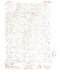
1985 Map of McCormack Spring
USGS Topo · Published 1986About this map
The Cortez Mountains dominate this high-desert landscape in northern Nevada, where water sources dictated the patterns of settlement and industry during the late twentieth century. In the northern reaches, McCormack Spring and various unnamed Springs provide rare moisture in the arid terrain, while the eastern edge is defined by the flow of Pine Creek and Trout Cr. The map captures the specialized land use of the Great Basin, from the isolated Rand Ranch to the small cluster at Cherry Springs. Evidence of mineral exploration appears in the western slopes, where several sites marked as Prospect indicate the region's long-standing mining interest. The topography is notably broken by Devils Gate, a significant pass through the high ridges that separate the drainage basins of this remote sector of Eureka County.
Find a feature on this map
11 named features on this map. Tap any name to fly to it.
Don’t see what you’re looking for? This feature index may not catch every label — zoom into the map to look around manually.
Map Details
Editions of this 1985 McCormack Spring Map
This is the sole edition of this map. No revisions or reprints were ever made.
Other maps of this area

1952 · Pine Valley
USGS Topo · 1:62,500

1952 · Carlin
USGS Topo · 1:62,500

1955 · Winnemucca
USGS Topo · 1:250,000

1957 · Frenchie Creek
USGS Topo · 1:62,500

1957 · Beowawe
USGS Topo · 1:62,500

1958 · Winnemucca
USGS Topo · 1:250,000

1962 · Winnemucca
USGS Topo · 1:250,000
1985 · Thatcher Spring
USGS Topo · 1:24,000

1985 · Scotts Gulch
USGS Topo · 1:24,000
1985 · Coffin Mtn
USGS Topo · 1:24,000