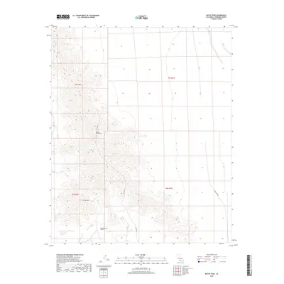
2018 Map of McCoy Peak
USGS Topo · Published 2018About this map
McCoy Peak rises as the central landmark in this 2018 survey of the California desert. The terrain is dominated by the McCoy Mountains, which stretch across the landscape above the wide Chuckwalla Valley to the south. This area is defined by its isolation and specialized infrastructure, featuring long straightaways like Gas Line Rd and Black Creek Rd that cut across the arid flats and lower foothills. The mapping of the township and range boundaries, including t6s r20e and t5s r21e, highlights the systematic division of this remote Riverside County landscape. The contrast between the jagged, steep contours of the peaks and the vast alluvial floor of the valley illustrates the classic Basin and Range geology typical of this region of the Colorado Desert.
Find a feature on this map
9 named features on this map. Tap any name to fly to it.
Don’t see what you’re looking for? This feature index may not catch every label — zoom into the map to look around manually.
Map Details
Editions of this 2018 McCoy Peak Map
This is the sole edition of this map. No revisions or reprints were ever made.
Other maps of this area

1942 · Blythe
USGS Topo · 1:250,000

1945 · Big Maria Mtns
USGS Topo · 1:62,500

1945 · Midland
USGS Topo · 1:62,500

1951 · Big Maria Mts
USGS Topo · 1:62,500

1951 · McCoy Wash
USGS Topo · 1:24,000

1952 · Midland
USGS Topo · 1:62,500

1952 · Mc Coy Spring
USGS Topo · 1:62,500

1952 · Ripley
USGS Topo · 1:24,000

1954 · Salton Sea
USGS Topo · 1:250,000

1955 · Salton Sea
USGS Topo · 1:250,000