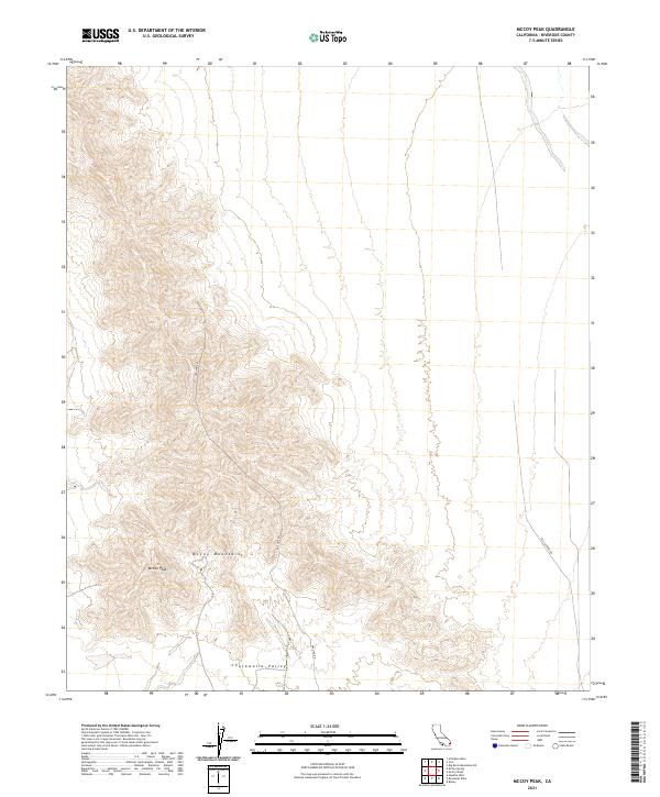
2021 Map of McCoy Peak
USGS Topo · Published 2021About this map
The McCoy Mountains dominate this 2021 landscape in Riverside County, rising sharply above the desert floor of the Chuckwalla Valley to the south. This modern survey illustrates a remote corner of the California desert where industrial infrastructure and raw topography converge. The presence of Gas Line Rd and Black Creek Rd indicates the sparse but critical network of utility and access routes that cut across the arid terrain. The high point of the range, McCoy Peak, serves as a prominent landmark for the region, overlooking a complex of dry washes and rugged ridges that define the local hydrology and land management boundaries.
Find a feature on this map
9 named features on this map. Tap any name to fly to it.
Don’t see what you’re looking for? This feature index may not catch every label — zoom into the map to look around manually.
Map Details
Editions of this 2021 McCoy Peak Map
This is the sole edition of this map. No revisions or reprints were ever made.
Other maps of this area

1942 · Blythe
USGS Topo · 1:250,000

1945 · Big Maria Mtns
USGS Topo · 1:62,500

1945 · Midland
USGS Topo · 1:62,500

1951 · Big Maria Mts
USGS Topo · 1:62,500

1951 · McCoy Wash
USGS Topo · 1:24,000

1952 · Midland
USGS Topo · 1:62,500

1952 · Mc Coy Spring
USGS Topo · 1:62,500

1952 · Ripley
USGS Topo · 1:24,000

1954 · Salton Sea
USGS Topo · 1:250,000

1955 · Salton Sea
USGS Topo · 1:250,000