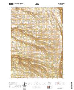
2020 Map of McCoy Ridge
USGS Topo · Published 2020About this map
McCoy Ridge anchors the eastern edge of this high-desert landscape in Harney County, characterized by an extensive network of drainages and upland water management. The terrain is marked by seasonal water courses such as Big Bridge Cr and Little Fir Cr that cut through the plateaus near Webb Canyon and Moon Hill. This 2020 survey illustrates a sophisticated system of water storage, including named features like Thompson Reservoir, Gil Thompson Reservoir, and the smaller Sagehen Reservoir.
Find a feature on this map
36 named features on this map. Tap any name to fly to it.
Don’t see what you’re looking for? This feature index may not catch every label — zoom into the map to look around manually.
Map Details
Editions of this 2020 McCoy Ridge Map
This is the sole edition of this map. No revisions or reprints were ever made.
Other maps of this area

1955 · Adel
USGS Topo · 1:250,000

1957 · Adel
USGS Topo · 1:250,000

1958 · Adel
USGS Topo · 1:250,000

1962 · Adel
USGS Topo · 1:250,000

1967 · Krumbo Reservoir
USGS Topo · 1:24,000

1967 · Page Springs
USGS Topo · 1:24,000

1968 · Poison Springs
USGS Topo · 1:24,000

1968 · Tombstone Canyon
USGS Topo · 1:24,000

1968 · Fish Lake
USGS Topo · 1:24,000

1968 · Wildhorse Lake
USGS Topo · 1:24,000