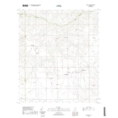
2020 Map of McCullough
USGS Topo · Published 2020About this map
Little River winds across the northern reaches of this rural landscape where the borders of Monroe, Baldwin, and Escambia counties converge. The area is characterized by a network of family-named landmarks and rural settlements that speak to a long history of local habitation. McCullough serves as a central point of reference, while the smaller communities of Booneville and Jack Springs are defined by their spiritual and ancestral foundations. Numerous burial grounds, including Lindsey Cem, Steadham Cem, and the Mothershed Cem, are scattered throughout the countryside, often located near local watercourses like Jim Boone Br and Perdido Cr. The intricate road system, from the historic Stage Coach Rd to the various county roads, connects these quiet hamlets and provides a clear picture of the region's contemporary rural structure.
Find a feature on this map
71 named features on this map. Tap any name to fly to it.
Don’t see what you’re looking for? This feature index may not catch every label — zoom into the map to look around manually.
Map Details
Editions of this 2020 McCullough Map
This is the sole edition of this map. No revisions or reprints were ever made.
Other maps of this area

1942 · Perdido
USGS Topo · 1:62,500

1944 · Perdido
USGS Topo · 1:62,500

1953 · Andalusia
USGS Topo · 1:250,000

1957 · Andalusia
USGS Topo · 1:250,000

1960 · Atmore
USGS Topo · 1:24,000

1960 · Huxford
USGS Topo · 1:24,000

1972 · Uriah East
USGS Topo · 1:24,000

1972 · Chrysler
USGS Topo · 1:24,000

1972 · Uriah West
USGS Topo · 1:24,000
1983 · McCullough
USGS Topo · 1:24,000