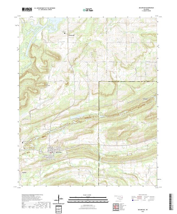
2022 Map of McCurtain
USGS Topo · Published 2022About this map
McCurtain anchors this map near the boundary between Haskell and Le Flore counties, its residential grid defined by streets like Main St and Jefford Ave. To the north and west, the landscape transitions from the waters of Sans Bois Creek and the southern reaches of the Robert S Kerr Reservoir toward the high ground of Seven Devils Mtn. The region's history is preserved at the Miners Cem west of town and the Iron Bridge Cem near Ironbridge, serving as important touchstones for local genealogical research. Small settlements such as Panther are situated among a dense network of local routes like Panther Hollow Rd and S Co Road 3720. Numerous watercourses, including Wildhorse Cr, Owl Cr, and Rock Cr, drain the terrain between the central valley and the elevation of Campground Spring Mtn in the east.
Find a feature on this map
86 named features on this map. Tap any name to fly to it.
Don’t see what you’re looking for? This feature index may not catch every label — zoom into the map to look around manually.
Map Details
Editions of this 2022 McCurtain Map
This is the sole edition of this map. No revisions or reprints were ever made.
Other maps of this area

1900 · Sansbois
USGS Topo · 1:125,000

1900 · Sallisaw
USGS Topo · 1:125,000

1909 · Sans Bois
USGS Topo · 1:125,000

1911 · Sallisaw
USGS Topo · 1:125,000

1911 · Sansbois
USGS Topo · 1:125,000

1946 · Fort Smith
USGS Topo · 1:250,000

1962 · Stigler East
USGS Topo · 1:24,000

1965 · Fort Smith
USGS Topo · 1:250,000

1967 · Fort Smith
USGS Topo · 1:250,000
1967 · Keota
USGS Topo · 1:24,000