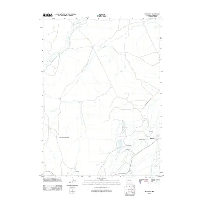
2012 Map of McFadden
USGS Topo · Published 2012About this map
McFadden stands as the primary settlement in this Wyoming landscape, positioned near the industrial activity of the Rock Creek Oil Field. The area is defined by a high-plains ranching economy, with several named properties such as Sims Ranch, McQuay Ranch, and White Ranch dotting the terrain. The hydrological network is dominated by the meandering Medicine Bow River in the northwest and the extensive drainage of Foote Cr, which cross-cuts the Upper Foote Creek Flats. Natural landmarks like Pine Ridge and managed water resources including the Pine Cone Number 1 Reservoir illustrate the local reliance on the land. The presence of the T L Cow Camp and the North Cross Ranch further emphasizes the enduring agricultural footprint of Carbon County in the early 21st century.
Find a feature on this map
19 named features on this map. Tap any name to fly to it.
Don’t see what you’re looking for? This feature index may not catch every label — zoom into the map to look around manually.
Map Details
Editions of this 2012 McFadden Map
This is the sole edition of this map. No revisions or reprints were ever made.
Other maps of this area

1914 · Saddleback Hills
USGS Topo · 1:62,500

1915 · Como Ridge
USGS Topo · 1:48,000

1918 · Como Ridge
USGS Topo · 1:62,500

1921 · Saddleback Hills
USGS Topo · 1:62,500

1954 · Rawlins
USGS Topo · 1:250,000

1958 · Rawlins
USGS Topo · 1:250,000

1958 · White Rock Canyon
USGS Topo · 1:24,000

1958 · Bengough Hill
USGS Topo · 1:24,000

1958 · Arlington
USGS Topo · 1:24,000

1958 · Mc Fadden
USGS Topo · 1:24,000