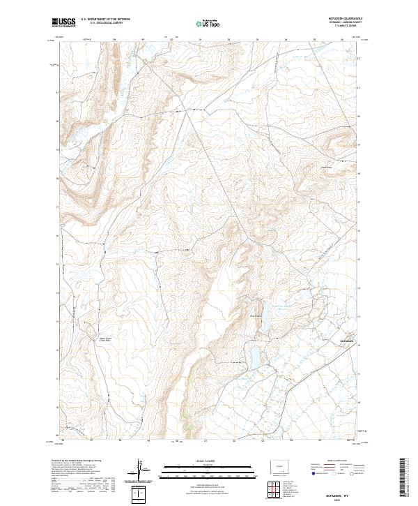
2021 Map of McFadden
USGS Topo · Published 2021About this map
The McFadden settlement anchors this high-plains landscape in Carbon County, where the transition from riparian zones to dry draws defines the local geography. To the north, the Medicine Bow River and Foote Cr shape the drainage patterns, supplemented by irrigation works like the Thornton Ditch. The presence of the Pine Cone Number 1 Reservoir and several Beaver Ponds along Watkins Cr suggests a reliance on managed water sources in this arid Wyoming environment. Significant landmarks include the wide expanse of the Upper Foote Creek Flats and the elevated terrain of Pine Ridge. Transportation through the area is maintained via the Medicine Bow-McFadden Rd, which links the sparse residential pockets to the broader region, while Willow Springs and Frank Draw provide specific reference points for those studying the natural hydrology and landform history of the Medicine Bow basin.
Find a feature on this map
22 named features on this map. Tap any name to fly to it.
Don’t see what you’re looking for? This feature index may not catch every label — zoom into the map to look around manually.
Map Details
Editions of this 2021 McFadden Map
This is the sole edition of this map. No revisions or reprints were ever made.
Other maps of this area

1914 · Saddleback Hills
USGS Topo · 1:62,500

1915 · Como Ridge
USGS Topo · 1:48,000

1918 · Como Ridge
USGS Topo · 1:62,500

1921 · Saddleback Hills
USGS Topo · 1:62,500

1954 · Rawlins
USGS Topo · 1:250,000

1958 · Rawlins
USGS Topo · 1:250,000

1958 · White Rock Canyon
USGS Topo · 1:24,000

1958 · Bengough Hill
USGS Topo · 1:24,000

1958 · Arlington
USGS Topo · 1:24,000

1958 · Mc Fadden
USGS Topo · 1:24,000