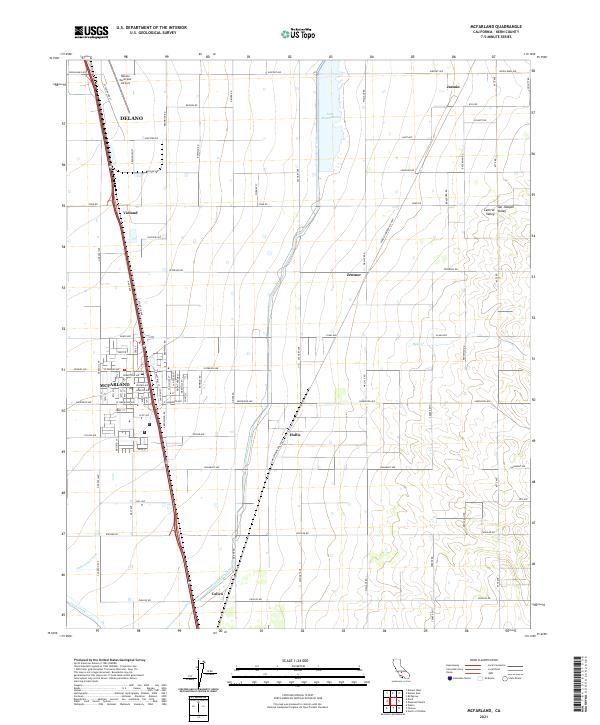
2021 Map of McFarland
USGS Topo · Published 2021About this map
The agricultural landscape of the southern Central Valley defines this region of Kern County, where the sprawling grid of orchards and vineyards is serviced by a complex irrigation network. The Friant-Kern Canal and Calloway Canal slice through the terrain, essential arteries for the intensive farming seen around McFarland and the southern edge of Delano. In the northeast, Lake Woollomes provides a distinct water feature near the settlement of Jasmin, while the Delano Municipal Airport serves as a modern transportation hub for the district. Small named points like Vinland, Hollis, and Zentner mark traditional intersections in this productive corridor. The map highlights the transition from the flat valley floor toward the eastern foothills, including natural watercourses like Poso Creek and Dyer Cr.
Find a feature on this map
47 named features on this map. Tap any name to fly to it.
Don’t see what you’re looking for? This feature index may not catch every label — zoom into the map to look around manually.
Map Details
Editions of this 2021 McFarland Map
This is the sole edition of this map. No revisions or reprints were ever made.
Other maps of this area

1906 · Bakersfield
USGS Topo · 1:62,500

1927 · McFarland
USGS Topo · 1:31,680

1929 · Delano
USGS Topo · 1:31,680

1929 · Richgrove
USGS Topo · 1:31,680

1929 · Stone
USGS Topo · 1:31,680

1930 · McFarland
USGS Topo · 1:31,680

1930 · Wasco
USGS Topo · 1:31,680

1930 · Pond
USGS Topo · 1:31,680

1930 · Famoso
USGS Topo · 1:31,680

1931 · Deepwell Ranch
USGS Topo · 1:31,680