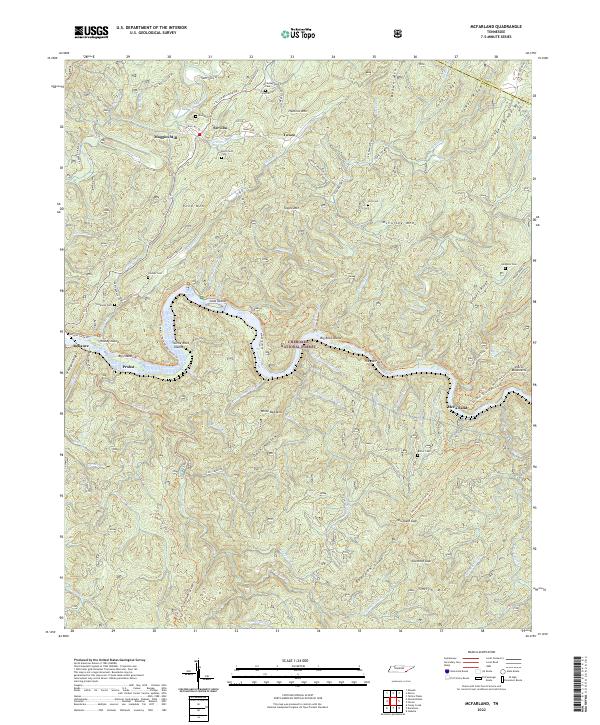
2022 Map of McFarland
USGS Topo · Published 2022About this map
The Hiwassee River cuts a deep, winding path through the Cherokee National Forest, defining the rugged geography of southeastern Tennessee near the Monroe and Polk County line. This landscape is characterized by a series of prominent ridges including Jones Ridge, Towee Ridge, and Finger Board Ridge, which overlook isolated settlements and family-named landmarks. The river itself is punctuated by significant landforms such as Big Island, Little Rock Island, and The Narrows.
Find a feature on this map
95 named features on this map. Tap any name to fly to it.
Don’t see what you’re looking for? This feature index may not catch every label — zoom into the map to look around manually.
Map Details
Editions of this 2022 McFarland Map
This is the sole edition of this map. No revisions or reprints were ever made.
Other maps of this area

1886 · Cleveland
USGS Topo · 1:125,000

1892 · Cleveland
USGS Topo · 1:125,000

1893 · Murphy
USGS Topo · 1:125,000

1895 · Cleveland
USGS Topo · 1:125,000

1901 · Cleveland
USGS Topo · 1:125,000

1914 · Murphy
USGS Topo · 1:125,000

1934 · Mecca
USGS Topo · 1:24,000

1934 · Tellico Plains
USGS Topo · 1:24,000

1935 · Tellico
USGS Topo · 1:48,000
1935 · Oswald Bald
USGS Topo · 1:24,000