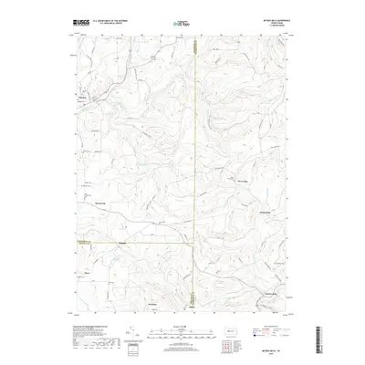
2019 Map of McGees Mills
USGS Topo · Published 2019About this map
Mahoning Creek and its complex network of tributaries, including the East Branch, carve through the rolling hills of this Pennsylvania landscape at the borders of Jefferson, Clearfield, and Indiana Counties. The terrain is dotted with small rural settlements and numerous family-named burial sites, such as the Slimmer Family Cem and the Rhoades Cem. These features, along with the Punxsutawney Reservoir, indicate a history of upland farming and water management. Transportation is defined by a dense web of local roads like McGees Mills Rd and Sandy Ridge Rd, which connect historical hamlets like Bowersville, Newtonburg, and McGees Mills. The presence of several distinct cemeteries, including Old Cumberland Cem and Mount Carmel Cem, serves as a valuable resource for those tracing local lineage and early settlement patterns in these township corners.
Find a feature on this map
86 named features on this map. Tap any name to fly to it.
Don’t see what you’re looking for? This feature index may not catch every label — zoom into the map to look around manually.
Map Details
Editions of this 2019 McGees Mills Map
This is the sole edition of this map. No revisions or reprints were ever made.
Other maps of this area

1903 · Curwensville
USGS Topo · 1:62,500

1906 · Punxsutawney
USGS Topo · 1:62,500

1922 · Du Bois
USGS Topo · 1:62,500

1924 · Du Bois
USGS Topo · 1:62,500

1929 · Penfield
USGS Topo · 1:62,500

1932 · Penfield
USGS Topo · 1:62,500

1939 · Curwensville
USGS Topo · 1:62,500

1939 · Punxsutawney
USGS Topo · 1:62,500

1942 · Curwensville
USGS Topo · 1:62,500

1942 · Punxsutawney
USGS Topo · 1:62,500
Featured Places
- Banks Township, PA
- Sidney, Banks Township
- Flora, Banks Township
- Clover Run, Bell Township
- Henderson Township, PA