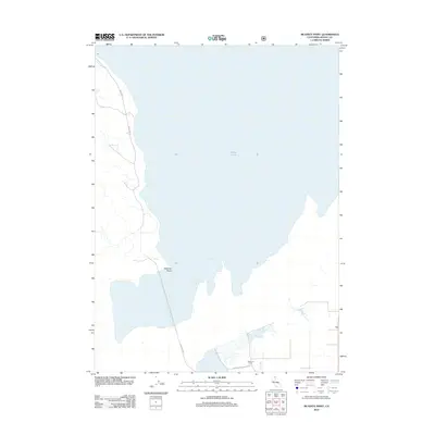
2012 Map of McGinty Point
USGS Topo · Published 2012About this map
Goose Lake dominates this 2012 survey of the California-Oregon border region in Modoc County. The map details the expansive eastern shoreline and the land-water interface at McGinty Point, where the terrain transitions from the lake bed to the surrounding basin. In the southern portion of the quadrangle, the localized agricultural footprint is visible at Lakeshore Ranch, situated near the mouth of Davis Cr. The infrastructure is sparse, characterized primarily by the long stretch of Westside Rd tracing the western margin of the lake and Lakeshore Rd serving the ranching area. This modern digital survey provides a precise record of the water levels and rural road networks, including the smaller Ake Reservoir to the northwest, documenting the landscape of the Great Basin's edge in the early 21st century.
Find a feature on this map
7 named features on this map. Tap any name to fly to it.
Don’t see what you’re looking for? This feature index may not catch every label — zoom into the map to look around manually.
Map Details
Editions of this 2012 McGinty Point Map
This is the sole edition of this map. No revisions or reprints were ever made.
Other maps of this area

1886 · Alturas
USGS Topo · 1:250,000

1892 · Alturas
USGS Topo · 1:250,000

1954 · Alturas
USGS Topo · 1:250,000

1958 · Alturas
USGS Topo · 1:250,000

1962 · Alturas
USGS Topo · 1:250,000

1962 · Davis Creek
USGS Topo · 1:62,500

1962 · Big Sage Reservoir
USGS Topo · 1:62,500

1962 · Willow Ranch
USGS Topo · 1:62,500

1962 · South Mountain
USGS Topo · 1:62,500

1965 · Alturas
USGS Topo · 1:250,000