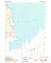
1990 Map of McGinty Point
USGS Topo · Published 1990About this map
Goose Lake dominates this northern California landscape, where the fluctuating shoreline creates a complex environment of marshes and mud flats. Along the western edge, the Modoc National Forest rises toward the mountains, sheltering the Ake Reservoir and several unnamed Springs. This 1990 provisional study captures the rural infrastructure of the region, including the extensive X L Ranch Indian Reservation which spans several sections of the shoreline.
Find a feature on this map
18 named features on this map. Tap any name to fly to it.
Don’t see what you’re looking for? This feature index may not catch every label — zoom into the map to look around manually.
Map Details
Editions of this 1990 McGinty Point Map
This is the sole edition of this map. No revisions or reprints were ever made.
Other maps of this area

1886 · Alturas
USGS Topo · 1:250,000

1892 · Alturas
USGS Topo · 1:250,000

1954 · Alturas
USGS Topo · 1:250,000

1958 · Alturas
USGS Topo · 1:250,000

1962 · Alturas
USGS Topo · 1:250,000

1962 · Davis Creek
USGS Topo · 1:62,500

1962 · Big Sage Reservoir
USGS Topo · 1:62,500

1962 · Willow Ranch
USGS Topo · 1:62,500

1962 · South Mountain
USGS Topo · 1:62,500

1965 · Alturas
USGS Topo · 1:250,000