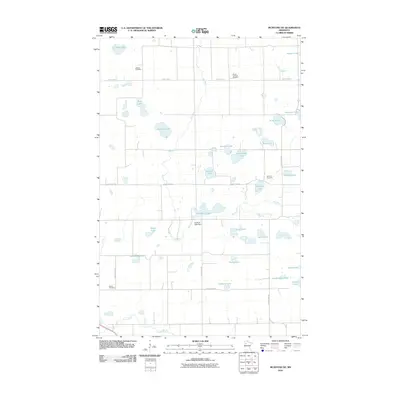
2010 Map of McIntosh NE
USGS Topo · Published 2010About this map
Glacial lakes and small watercourses define this rural pocket of Polk County, where the Hill River and Poplar River carve through a landscape of family-named water bodies. The geography is characterized by a dense concentration of small basins like Evenmoe Lake, Agnes Lake, and Raben Lake, many of which appear to be remnant wetlands or kettle ponds. Human infrastructure is subtly overlaid on this watery terrain, marked by the Hill River Lake Dam and a grid of rural routes including County Hwy-5 and NE Cottage Ave. For those tracing local heritage, several burial grounds are preserved across the sections, including Oakland Cemetery, Vernes Lutheran Cemetery, and the curiously named Asphalt Cemetery. This distribution of cemeteries and modest lake-side landmarks reflects the dispersed agricultural and lakeside settlement pattern typical of the northwestern Minnesota prairie-forest transition.
Find a feature on this map
36 named features on this map. Tap any name to fly to it.
Don’t see what you’re looking for? This feature index may not catch every label — zoom into the map to look around manually.
Map Details
Editions of this 2010 McIntosh NE Map
This is the sole edition of this map. No revisions or reprints were ever made.
Other maps of this area

1919 · Fosston
USGS Topo · 1:62,500

1919 · Grit
USGS Topo · 1:62,500

1919 · Winsor
USGS Topo · 1:62,500

1954 · Bemidji
USGS Topo · 1:250,000

1957 · Bemidji
USGS Topo · 1:250,000

1958 · Bemidji
USGS Topo · 1:250,000

1969 · Olga
USGS Topo · 1:24,000

1969 · Mc Intosh NE
USGS Topo · 1:24,000

1969 · Fosston East
USGS Topo · 1:24,000
1969 · Mc Intosh
USGS Topo · 1:24,000