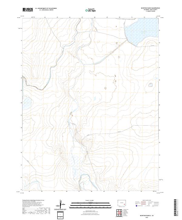
2022 Map of McIntosh Ranch
USGS Topo · Published 2022About this map
The arid landscape of Bent County is defined by an intricate network of irrigation infrastructure designed to harness the waters of Adobe Cr. Central to this water management system is the massive Adobe Creek Reservoir, which dominates the northeastern portion of the quadrangle. The map documents the vital role of the Fort Lyon Canal and its associated storage systems, which were essential for transforming the high plains into productive agricultural land.
Find a feature on this map
17 named features on this map. Tap any name to fly to it.
Don’t see what you’re looking for? This feature index may not catch every label — zoom into the map to look around manually.
Map Details
Editions of this 2022 McIntosh Ranch Map
This is the sole edition of this map. No revisions or reprints were ever made.
Other maps of this area

1891 · Las Animas
USGS Topo · 1:125,000

1893 · Las Animas
USGS Topo · 1:125,000

1953 · Las Animas
USGS Topo · 1:24,000

1953 · Cornelia
USGS Topo · 1:24,000

1953 · Hadley
USGS Topo · 1:24,000

1954 · Lamar
USGS Topo · 1:250,000

1955 · Mc Intosh Ranch
USGS Topo · 1:24,000

1955 · Bishop Ranch
USGS Topo · 1:24,000
1955 · Lewis Ranch
USGS Topo · 1:24,000

1958 · Lamar
USGS Topo · 1:250,000