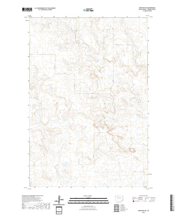
2021 Map of McIntosh SW
USGS Topo · Published 2021About this map
Soldier Cr and Little Soldier Cr define the drainage patterns of this rural Corson County landscape, cutting through a section of the Great Plains characterized by its township-and-range organization. The map shows a transition in terrain between t22n r21e and t21n r22e, where the intermittent flow of Hump Cr marks the northern reaches. This 2021 survey illustrates a quiet prairie environment where human presence is primarily marked by the rectilinear grid of local roads like 235th Ave and 109th St. The sparse infrastructure, limited to these section-line routes and various ranch roads, suggests a landscape dedicated almost entirely to open-range grazing or agriculture, preserving the topographic character of this part of South Dakota into the early 21st century.
Find a feature on this map
15 named features on this map. Tap any name to fly to it.
Don’t see what you’re looking for? This feature index may not catch every label — zoom into the map to look around manually.
Map Details
Editions of this 2021 McIntosh SW Map
This is the sole edition of this map. No revisions or reprints were ever made.
Other maps of this area

1953 · McIntosh
USGS Topo · 1:250,000

1956 · Black Horse NE
USGS Topo · 1:24,000

1956 · Cottonwood Creek NE
USGS Topo · 1:24,000

1956 · Black Horse
USGS Topo · 1:24,000

1958 · McIntosh
USGS Topo · 1:250,000

1972 · McIntosh SW
USGS Topo · 1:24,000

1972 · Morristown SE
USGS Topo · 1:24,000

1972 · Watauga
USGS Topo · 1:24,000

1972 · Hump Butte
USGS Topo · 1:24,000
1972 · McIntosh SE
USGS Topo · 1:24,000