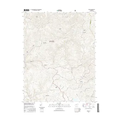
2016 Map of McKee
USGS Topo · Published 2016About this map
McKee and Gray Hawk serve as the primary hubs in this section of Jackson County, where the hills of the Daniel Boone National Forest meet local homesteads. The landscape is defined by a dense network of ridges and hollows, such as Lime Kiln Ridge, Brushy Ridge, and Tattlers Hollow, which historically dictated the placement of small settlements and family farms. Local-history researchers will find numerous named roads reflecting family lineages, including Farmer Cemetery Rd, Hiram Smith Rd, and Burb Vickers Rd. The map also traces the transition from wooded forest land to established communities like Macedonia, New Zion, and Atkinstown. Water features are relatively sparse in this upland terrain, though Tyner Lake and the drainage of Steer Fork provide critical landmarks for those studying the physical geography and development of the region during the early 21st century.
Find a feature on this map
35 named features on this map. Tap any name to fly to it.
Don’t see what you’re looking for? This feature index may not catch every label — zoom into the map to look around manually.
Map Details
Editions of this 2016 McKee Map
This is the sole edition of this map. No revisions or reprints were ever made.
Other maps of this area

1891 · Manchester
USGS Topo · 1:125,000

1892 · Richmond
USGS Topo · 1:125,000

1892 · Beattyville
USGS Topo · 1:125,000

1893 · London
USGS Topo · 1:125,000

1897 · Richmond
USGS Topo · 1:125,000

1897 · London
USGS Topo · 1:125,000

1952 · Alcorn
USGS Topo · 1:24,000

1952 · Leighton
USGS Topo · 1:24,000

1952 · Heidelberg
USGS Topo · 1:24,000

1953 · Mc Kee
USGS Topo · 1:24,000