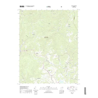
2019 Map of McKee
USGS Topo · Published 2019About this map
McKee serves as the focal point for this section of Jackson County, situated at the edge of the Daniel Boone National Forest. The landscape is defined by a dense network of ridges and hollows, such as Brushy Ridge and Neil Hollow, which dictate the winding paths of rural routes like Soaptown Rd and Spurlock Store Rd. Small settlements and named communities are scattered throughout these valleys, including Macedonia, Gray Hawk, and Atkinstown.
Find a feature on this map
71 named features on this map. Tap any name to fly to it.
Don’t see what you’re looking for? This feature index may not catch every label — zoom into the map to look around manually.
Map Details
Editions of this 2019 McKee Map
This is the sole edition of this map. No revisions or reprints were ever made.
Other maps of this area

1891 · Manchester
USGS Topo · 1:125,000

1892 · Richmond
USGS Topo · 1:125,000

1892 · Beattyville
USGS Topo · 1:125,000

1893 · London
USGS Topo · 1:125,000

1897 · Richmond
USGS Topo · 1:125,000

1897 · London
USGS Topo · 1:125,000

1952 · Alcorn
USGS Topo · 1:24,000

1952 · Leighton
USGS Topo · 1:24,000

1952 · Heidelberg
USGS Topo · 1:24,000

1953 · Mc Kee
USGS Topo · 1:24,000