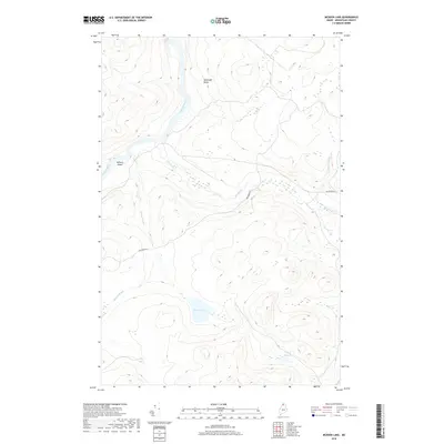
2018 Map of McKeen Lake
USGS Topo · Published 2018About this map
The Allagash River winds through this undeveloped portion of Aroostook County, passing McKeen Island and the turbulent Spring Bank Rapids. The landscape is defined by its complex hydrography, where the main river channel is fed by numerous tributaries including Big Brook, McKeen Brook, and Squirrel Brook. Away from the river banks, the terrain rises toward landmarks like McGargle Rocks. Evidence of human passage in this wilderness is limited to the winding path of Big Brook Rd, which provides access to the interior. The presence of McKeen Lake and Mink Pond further illustrates the water-heavy nature of this territory, which remains dominated by natural features rather than established settlements.
Find a feature on this map
10 named features on this map. Tap any name to fly to it.
Don’t see what you’re looking for? This feature index may not catch every label — zoom into the map to look around manually.
Map Details
Editions of this 2018 McKeen Lake Map
This is the sole edition of this map. No revisions or reprints were ever made.
Other maps of this area

1930 · Allagash
USGS Topo · 1:48,000

1930 · St Francis
USGS Topo · 1:48,000

1931 · Fish River Lake
USGS Topo · 1:48,000

1932 · Allagash Falls
USGS Topo · 1:48,000

1933 · Allagash
USGS Topo · 1:62,500

1933 · St Francis
USGS Topo · 1:62,500

1935 · Fish River Lake
USGS Topo · 1:62,500

1935 · Allagash Falls
USGS Topo · 1:62,500

1954 · Presque Isle
USGS Topo · 1:250,000

1956 · Allagash Falls
USGS Topo · 1:50,000