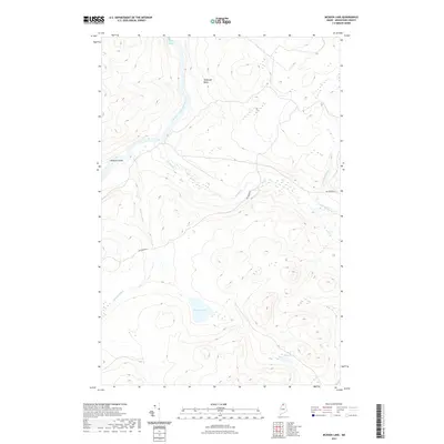
2021 Map of McKeen Lake
USGS Topo · Published 2021About this map
The Allagash River winds through this northern Maine landscape, characterized by its complex network of waterways and secluded basins. In the northern reaches of the quadrangle, the river flows past Spring Bank Rapids and the prominent McGargle Rocks, revealing the physical challenges navigated by early river travelers. Centered in the map is McKeen Lake, which feeds into the eponymous McKeen Brook, while Mink Pond sits further south. The presence of Big Brook Rd provides the primary overland access through this timberland region, crossing over Big Brook and Squirrel Brook. This 2021 survey documents a terrain where drainage patterns and water bodies like McKeen Island dictate the movement of people and resources.
Find a feature on this map
10 named features on this map. Tap any name to fly to it.
Don’t see what you’re looking for? This feature index may not catch every label — zoom into the map to look around manually.
Map Details
Editions of this 2021 McKeen Lake Map
This is the sole edition of this map. No revisions or reprints were ever made.
Other maps of this area

1930 · Allagash
USGS Topo · 1:48,000

1930 · St Francis
USGS Topo · 1:48,000

1931 · Fish River Lake
USGS Topo · 1:48,000

1932 · Allagash Falls
USGS Topo · 1:48,000

1933 · Allagash
USGS Topo · 1:62,500

1933 · St Francis
USGS Topo · 1:62,500

1935 · Fish River Lake
USGS Topo · 1:62,500

1935 · Allagash Falls
USGS Topo · 1:62,500

1954 · Presque Isle
USGS Topo · 1:250,000

1956 · Allagash Falls
USGS Topo · 1:50,000