2023 Map of McKenna
USGS Topo · Published 2023About this map
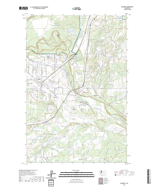
McKenna and Yelm anchor a landscape defined by the winding Nisqually River and the hydraulic engineering of the Centralia Canal. This modern survey illustrates the proximity of civilian life to the sprawling Joint Base Lewis-McChord, which occupies much of the northern terrain near Mock City and Lewis Lake. The region’s agricultural roots are evident in the wide expanses of Yelm Prairie and Smith Prairie, while its transportation history is marked by the path of the Northern Pacific Rd SE. For those researching family history, the map provides precise locations for the Yelm Public Cem and Roy Cem. Modern aviation also leaves its mark through facilities like the Western Airpark and Flying B Airport, reflecting a transition from the area's older river-and-rail economy to contemporary utility.
Find a feature on this map
136 named features on this map. Tap any name to fly to it.
Don’t see what you’re looking for? This feature index may not catch every label — zoom into the map to look around manually.
Map Details
Editions of this 2023 McKenna Map
This is the sole edition of this map. No revisions or reprints were ever made.