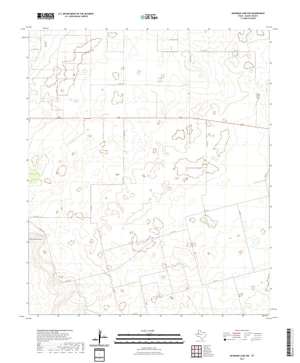
2022 Map of McKenzie Lake NW
USGS Topo · Published 2022About this map
Seminole Draw carves a subtle path through this Gaines County landscape, representing a significant ephemeral drainage feature in a region defined by its wide, open spaces. The map reveals a systematic grid of rural transit, where Co Rd 104 and Co Rd 121 provide access to the northern reaches, while Ranch RD 303 serves as a primary north-south artery. This 2022 survey by the U.S. Geological Survey details a landscape marked by scattered depressions and an extensive network of county roads like Fairview Rd and Co Rd 412. The presence of highway 180 bisecting the center suggests a corridor of modern connectivity through the ranchlands of West Texas, offering a clear view of how local infrastructure accommodates the vast distances between rural properties.
Find a feature on this map
16 named features on this map. Tap any name to fly to it.
Don’t see what you’re looking for? This feature index may not catch every label — zoom into the map to look around manually.
Map Details
Editions of this 2022 McKenzie Lake NW Map
This is the sole edition of this map. No revisions or reprints were ever made.
Other maps of this area

1954 · Hobbs
USGS Topo · 1:250,000

1958 · Hobbs
USGS Topo · 1:250,000

1970 · Seminole NE
USGS Topo · 1:24,000

1970 · Cedar Point Ranch
USGS Topo · 1:24,000

1970 · Seagraves SE
USGS Topo · 1:24,000

1970 · McKenzie Lake NW
USGS Topo · 1:24,000

1970 · Seminole SE
USGS Topo · 1:24,000

1970 · McKenzie Lake SE
USGS Topo · 1:24,000
1970 · Loop SW
USGS Topo · 1:24,000

1970 · McKenzie Lake
USGS Topo · 1:24,000